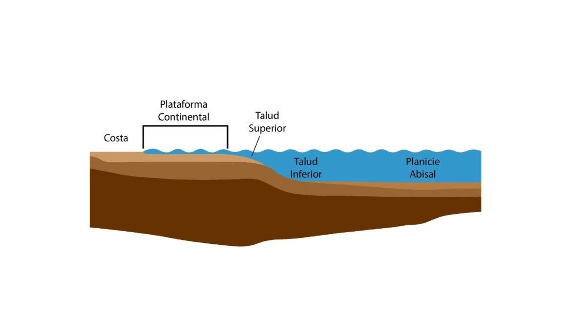
Coastal Dynamics
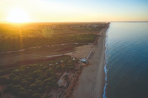
The mouth of the Almargem stream is a remnant lagoon of an ancient estuary that existed in this region until at least the Roman period. Over time, this estuary has degraded due to constant silting caused by the accumulation of sediments transported by the Almargem stream.
When the lagoon is fully flooded, it can reach lengths of up to 830 meters and widths of 185 meters, but it never exceeds a depth of 5 meters. To the south, close to the sea, a sandy coastal dune belt forms a natural barrier that restricts the lagoon's water from flowing freely into the ocean. However, during certain occasions, such as very high tides or strong storms, the sea can breach this barrier, mixing seawater with freshwater and partially renewing the lagoon.
The banks of the Almargem lagoon are bordered by small elevations formed from weakly consolidated sandstones and conglomerates, which belong to the Quarteira Sands unit of Upper Pleistocene age. This unit creates small coastal cliffs to the east and west of the Almargem mouth, which are experiencing significant coastal erosion, with retreats measuring several meters per year.
Human presence in this region dates back thousands of years. Millennia ago, local communities shaped the landscape through traditional agriculture, establishing orchards, vegetable gardens, and grazing areas. These activities have significantly impacted the region's fauna and flora, helping to define the current ecosystem of this lagoon.
Locality: Quarteira